
www.rosepoint.com
|
Rose Point ECSRose Point ECS™ improves operational efficiency, situational awareness, and decision making with straightforward, uncluttered displays and controls that provide instant access to the information professional mariners and fleet operators need to navigate safely. Rose Point ECS is the industry-leading navigation software and the number one selling navigation software for inland vessels in the United States. With Rose Point ECS you get the most comprehensive user experience and sophisticated navigation tools available all in one package. Key Benefits
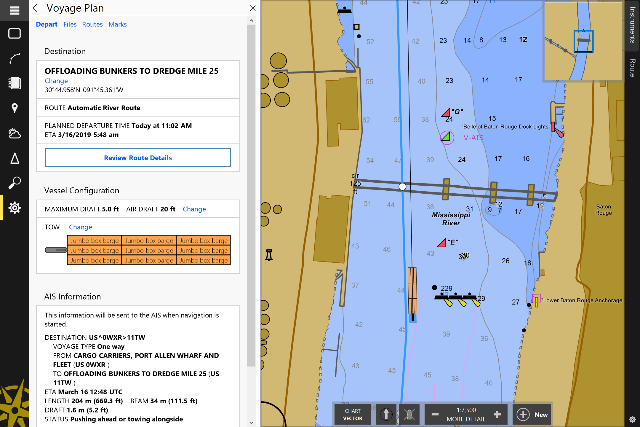
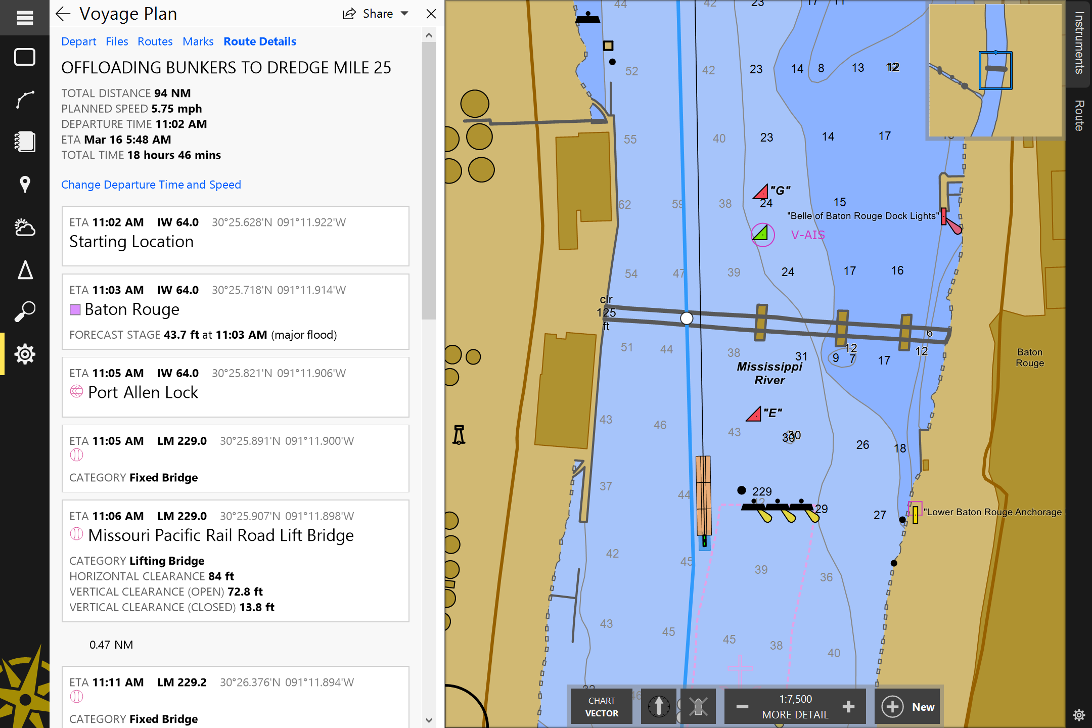
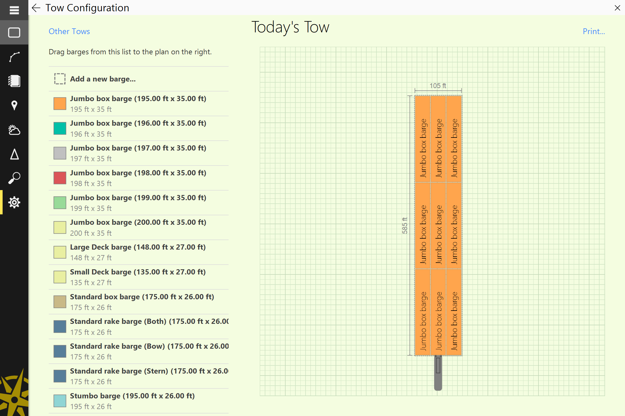
Planning and NavigationRose Point ECS lets you plan an unlimited number of routes and waypoints, provides for boundary areas with speed limit alarms, and includes many other planning and drawing tools. Only Rose Point ECS lets you organize those routes and marks into voyage plan documents which are easily archived, printed, shared, and transferred between PCs.
When underway, Rose Point ECS provides you with the information you need with a quick glance at its clear, customizable displays and logical controls.
+Inland Add-OnThe features of +Inland are ideal for vessels operating on the inland waterways.
Download Rose Point ECS 4 |
|
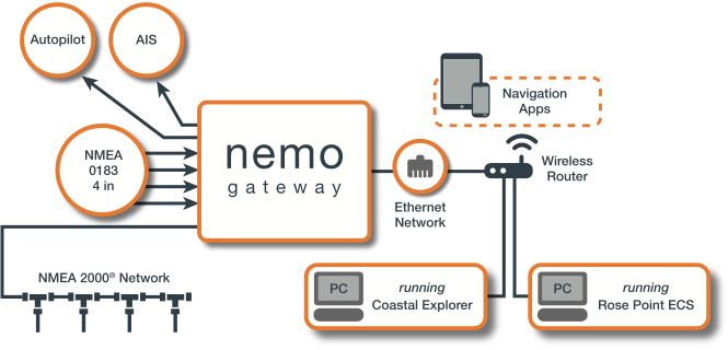
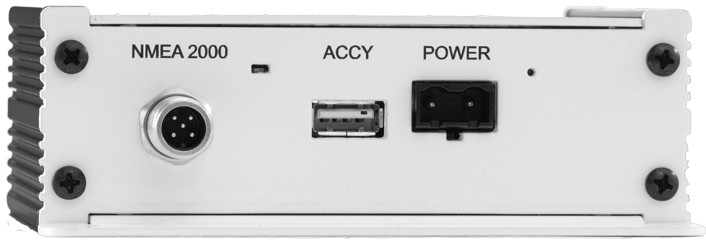
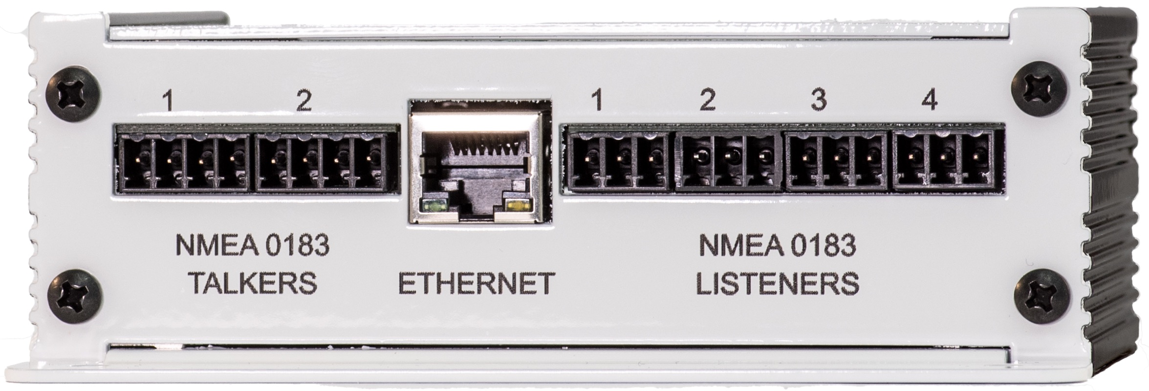
NEMO gateway (NMEA0182/2000)Get ConnectedThe nemo gateway connects your onboard data systems to provide your PCs, tablets, and phones access to all of your marine electronics. It can also translate information between NMEA 2000 and NMEA 0183 so you can use a combination of older and newer devices rather than upgrading everything at once. The certified NMEA 2000® network connection ensures compatibility with your newer devices while the standard NMEA 0183 connections let you keep using your older devices. The nemo gateway works great with Rose Point ECS and Coastal Explorer, but it also works with any other app that can use NMEA 0183 data over a TCP or UDP network connection. The Ethernet interface allows multiple PCs, tablets, phones, and other networked devices to access instrument data and even control your autopilot. Simple ConfigurationOn many vessels, the nemo gateway starts working right after you hook it up and does not require any configuration. More complex systems can be configured using Rose Point ECS, Coastal Explorer, or the Nemo Gateway app for iOS and Android. Configuration options include sensor priorities, NMEA 2000 PGN output, per-port NMEA 0183 sentence output, NMEA 0183 port speeds, and more. |
|
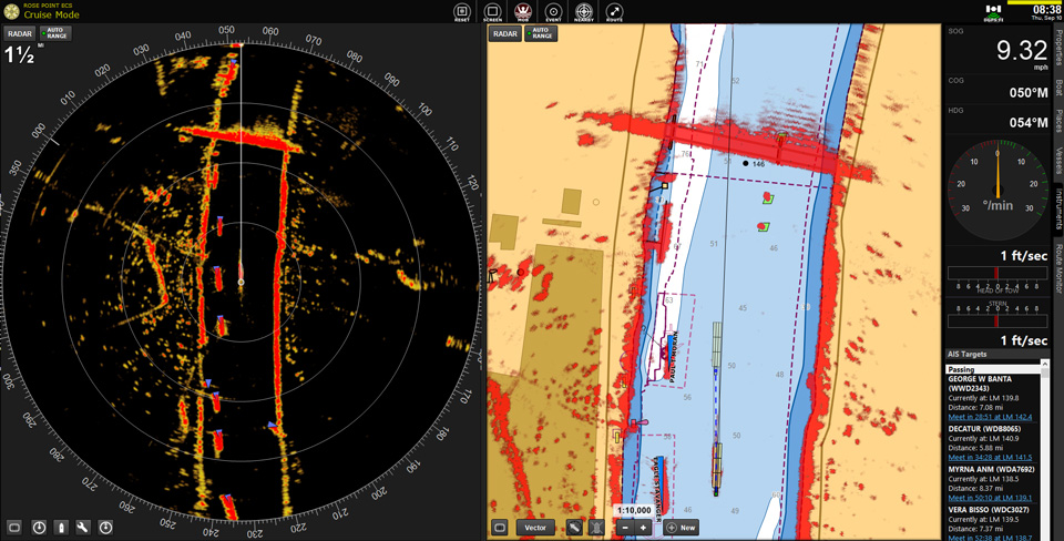
Radar OverlayFull-featured for the professional mariner
Unparalleled image qualityUnlike other products which use an analog signal, the innovative design of the Commercial Radar Interface uses an all-digital interface for data transfer that ensures the highest level of image quality. Radar Overlay DatasheetBack to top |